

The title for this post is a famous line from a letter that naturalist John Muir wrote to his sister in 1873. He was not writing about the Blue Ridge, but he expressed something with which many North Carolinians readily identify.
Tar Heel love for the Blue Ridge is not exactly genetic, but it often is infused at an early age. When I talk to North Carolinians about their earliest nature-related memories, they often talk about riding along some stretch of the Blue Ridge Parkway.

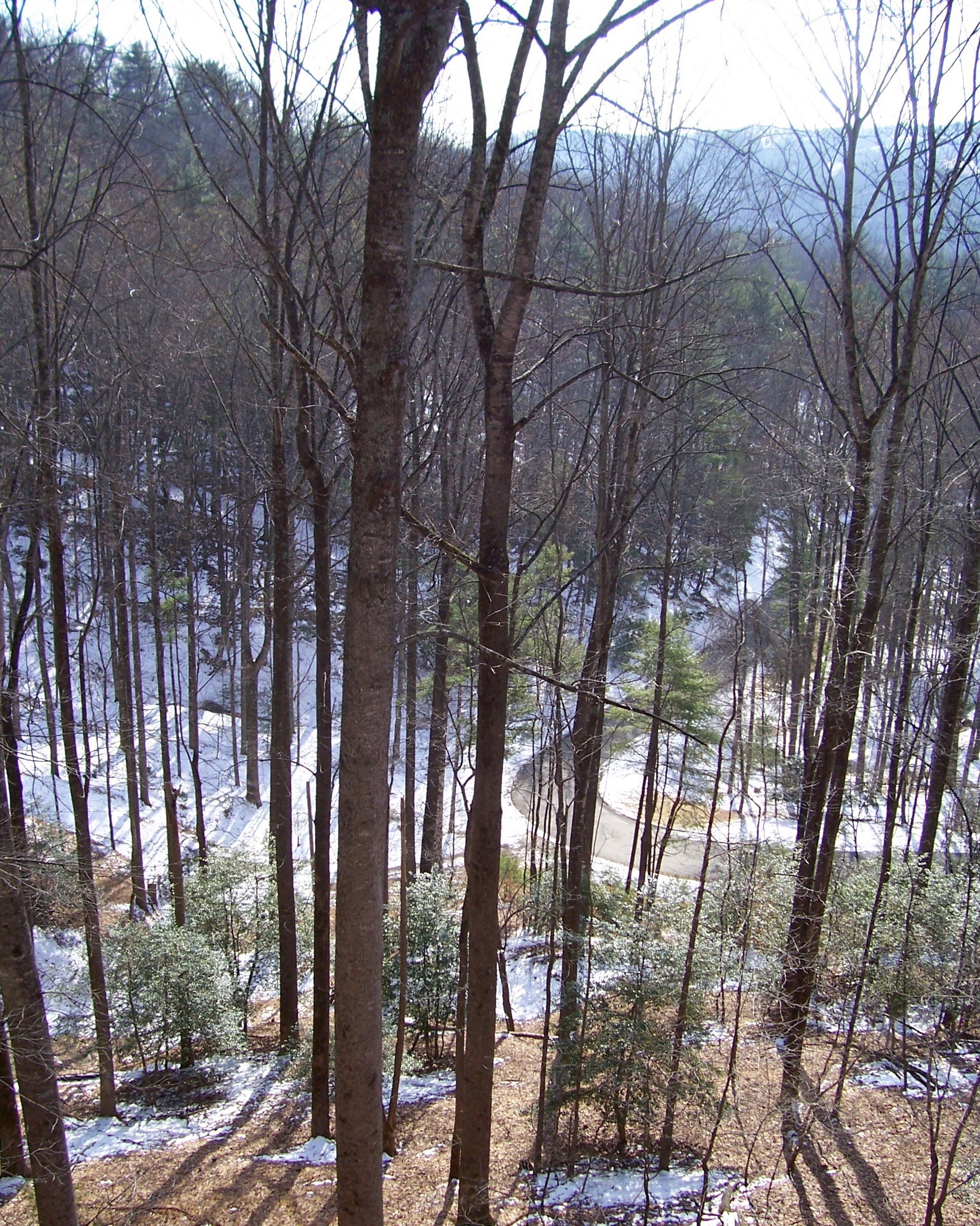
The Parkway is so unlike any other road–essentially a freeway intentionally designed to make the driver slow down, with countless places along the way where you actually want to stop–that it is not hard to understand why it makes such a strong impression on children, especially those who spend a lot of their formative years on bland interstates in the backs of family cars. The Parkway has an entirely different feel from other roads, as if it has been there a lot longer than even the automobile, a Colonial-era holdover that hearkens to an otherwise-lost moment in time.
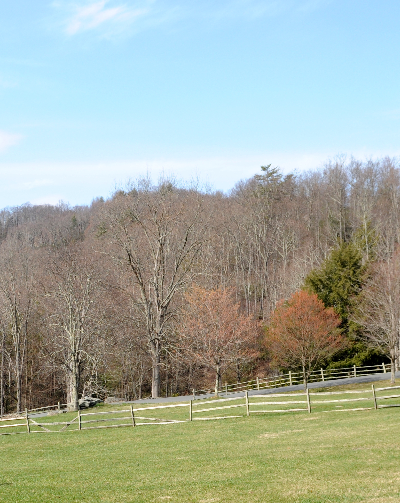
Whereas driving the North Carolina coast often is about the now and about the push-pull juxtaposition of natives and tourists, driving the Blue Ridge Parkway is much more about the past, and about wrestling with the feeling that one is somehow encroaching on territory that belongs not only to the people who have called the region home for centuries but also to the wildlife, often so much more abundant here than on the over-developed coast.
The Parkway terminals in North Carolina are the Virginia state line, near Boone, on the north end, and Cherokee, near the beginning of the sister-road Great Smoky Mountains route, on the south end. It is entirely possible to drive the whole stretch point-to-point in about 7 hours, which for Parkway neophites may make it seem like a poor choice for a week-long drive. But one of the beauties of the Parkway is that, despite the fact that it is a road, the experience is about just how far away from a road the Parkway can take you. Running alongside the Parkway are a series of twisting hiking trails and pathways–including in some spots the Appalachian Trail–that parallel the route and remind even the most dedicated driver that a Parkway experience is about getting out of the car, not staying in it. The longest stretch between designated landmarks is only 15 miles, with most landmarks no more than a few miles from each other, so frequent stopping is encouraged. There are destination towns all along the route (Asheville and Blowing Rock in particular), but, as with the Parkway itself, those towns obligingly play second fiddle to the vast landscapes that open up at each turn and offer spectacular views year-round of what a world without such towns looks like.
But perhaps the most compelling component of the drive for me–and one that many drivers experience only subconsciously–is the silence. No cross-street traffic, no horns, no pedestrians (other than hikers), no air conditioning units, no garbage trucks–just the sound of the birds and wind in the trees accompanied by the occasional soft whoosh of a car. It is like driving on a little-used back road, only without the clear-cut feel of a standard state-maintained two-lane highway, and instead of gas stations and fast food restaurants every few miles, there are breathtaking overlooks, historical sites, and little else.
My first two drives for this website were week-long adventures with many stops–and many miles between stops. This third drive is conveniently book-ended by two meetings I will be attending for work–one in Union County and the second in Alexander County. In between, I will be meandering from the Cherokee entrance to the Virginia state line, going no more than an hour or two each day, and stopping at many of the mileposts along the way–some familiar and some new to me. In essence, in the spirit of the Parkway, I hope to make this drive about not driving.
I don’t leave until September 23rd, so please feel free to post suggested stops in the comments section below. I’ve included my initial tentative schedule, to give you some idea of where I am likely to be on each day.
* * *
UPDATE: Be sure to read this article in today’s (9/13/15) News & Observer about financial challenges the Blue Ridge Parkway has been facing over the past five years.
* * *
Draft Blue Ridge Parkway Driving Schedule
Thursday, September 24th – from Indian Trail (Union County) to Cherokee
Parkway Start Point: Mile Post 469.1
Friday, September 25th – from Cherokee to Sylva/Waynesville area
Mile Post 469.1-431.0
- 458.2: Heintooga Ridge Rd. Spur to Mile High Overlook. 12 miles to Great Smoky Mtns. National Park Campground
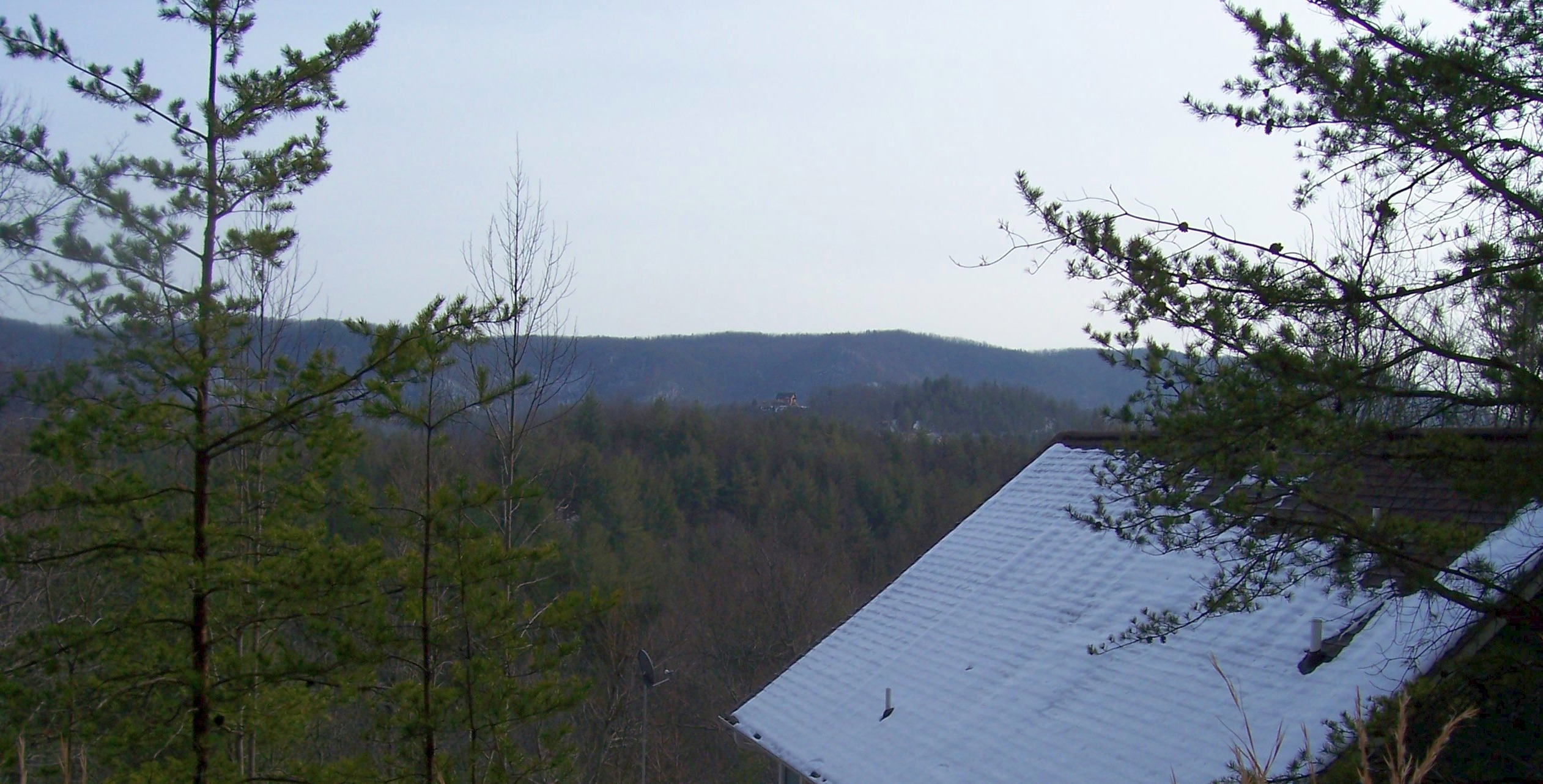
- 451.2: Waterrock Knob Parking Overlook. Visitor Information Center, Comfort Station. 4-State view including fine panorama of the Great Smoky Mountains. Trail, with pedestrian overlooks, to the Knob.
- 431.4: Richland Balsam Overlook. Highest point on Blue Ridge Parkway: Alt. 6,047.
- 431.0: Haywood-Jackson Overlook. 1½-mile self-guided loop trail, of moderate difficulty, to summit of Richland Balsam.
Saturday, September 26th – from Sylva/Waynesville area to Pisgah
Mile Post 431.0-408.8
- 422.4: Devil’s Courthouse Parking Area. Strenuous ½-mile hike to “Courthouse” for 360-degree view. Sensitive habitat area.
- 418.8: Graveyard Fields Overlook. Loop trail of moderate difficulty, 2.3 miles, to Yellowstone Falls.
- 417.0: Looking Glass Rock. So named because it reflects light brilliantly when water and ice are on the rock’s granite face.
- 408.6: Mount Pisgah. Campground, picnic area, trails.
Sunday, September 27th – from Psisgah to Asheville
Mile Post 408.8-382.0
- 384.0: Blue Ridge Parkway Visitor Center.
- 382.6: Asheville attractions, breweries, restaurants, Biltmore, etc.
- 382.0: Southern Highland Folk Art Center.
Monday, September 28th – from Asheville to Little Switzerland/Spruce Pin
Mile Post 382.0-334.0
- 364.4: Craggy Gardens Visitor Center. Information, exhibits, publications, trails.
- 355.4: Mount Mitchell State Park. Highest Peak in Eastern USA.
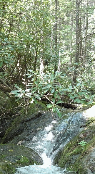
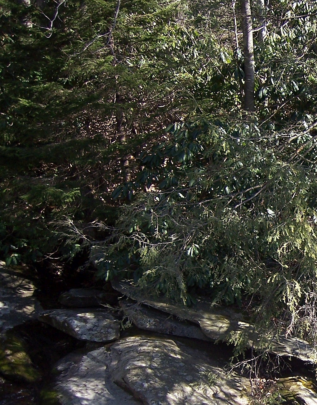
- 339.5: Crabtree Falls. 250 acres. Hiking, picnic area, camping, comfort station, drinking water. 40-minute walk to Crabtree Falls.
Tuesday, September 29th – from Little Switzerland/Spruce Pine to Boone/Deep Gap
Mile Post 334.0-276.4
- 331.0: Overmountain Victory National Historic Trail.
- 331.0: Museum of North Carolina Minerals.
- 320.7: Chestoa View. Offers an unusually fine view from one of the many vertical cliffs on Humpback Mountain.
- 317.4: Linville Falls Winery.
- 316.3: Linville Falls. Visitor Center, campground and picnic area, trail to overlooks of falls and gorge.
- 308.2: Flat Rock Parking Area. Self-guiding nature trail to superb view of Linville Valley and Grandfather Mountain.
- 304.4: Linn Cove Viaduct Information Center. Trail access viaduct. Alt. 4,000.
- 295.0: Julian Price Memorial Park. 4,344 acres.
- 294.0: Historic Flat Top Manor House; Parkway Craft Center; comfort station; visitor information, publications.
- 292.7: Moses H. Cone Memorial Park. 3,600 acres. Many miles of horse and carriage trails, hiking, fishing.
Wednesday, September 30th – from Boone/Deep Gap to NC/VA Line (Lowgap, NC)
Mile Post 276.4-213.0
- 272.0: E. B. Jeffress Park. Picnic area, Comfort station, trail to Cascades.
- 246.0: Thistle Meadow Winery.
- 238.5: Doughton Park.
- 218.6: Fox Hunters Paradise. Overlook and parking area. 10 minutes by trail to the Paradise, where old-time hunters listened to their hounds. Alt. 2,805.
- 217.5: Cumberland Knob. 15-minute loop trail to Cumberland Knob. (Elev. 2,855). Loop trail into Gully Creek Gorge. 2 hours.
- 216.9: NC–VA State Line. Alt. 2,547.
- 213.0: Blue Ridge Music Center.

My wife and I loved Linville Falls, sorry but very scenic walk with great views of the falls. Also highly recommend the caverns near by. Again just a short hike in and out with some very unique features, including schools of mountain trout swimming at your feet.
LikeLike
*short* walk that is. Definitely not a sorry one.
LikeLike
Too bad you’re not crossing the VA line. My group of friends regularly stay at the Mountain Top Motel in Fancy Gap, VA. If you’re there on a weekend Peter, the owner and serial entrepreneur from Charlotte, would likely be around. You’d likely be able to lure him out on the front stoop and after a couple of drinks, regale you in wonderful stories all night.
Our first day of biking on the Parkway usually takes us down to Freeborne’s in Laurel Springs. I nice, but minimal lunch spot. I bigger lunch spread and really friendly staff can be found at the Stop & Shop Cafe, also in Laurel Springs.
LikeLike
Sounds like a great trip. I can’t wait to read about your experience and see your pictures. In the mountains you never know what is around the next corner. Enjoy this adventure!
LikeLike
One of the most beautiful views along the Parkway is the view from Rough Ridge. A short but steep hike through woods and along a boardwalk to a spectacular overlook.
WHERE IS IT? Blue Ridge Parkway, MP 302.8 between the Holloway Mountain Road exit and the Linn Cove Viaduct. Park at the Rough Ridge overlook, and the trailhead goes up to the right.
http://blueridgencguide.com/2011/04/10/hiking-trails-rough-ridge-blue-ridge-parkway/
LikeLike
Check out Black Balsam Knob, great for a sunset or a sunrise. > http://www.hikewnc.info/trailheads/pisgah-national-forest/pisgah-ranger-district/black-balsam/
Crabtree Falls and Craggy Gardens (already on-list) are awesome. Be sure to check out Wicked Weed when you’re in Asheville if you haven’t been. If you like sour beers they have the Funkatorium as well which is usually less busy.
LikeLike
See, another vote for the Funkatorium!
LikeLike