

When I was a kid, I used to while away hours on long car drives by studying the maps we kept in the car. In addition to learning the names of the small towns that dot the Virginia and North Carolina countrysides (the two maps that were always in our car), I also started to think about how roads were a good metaphor for connectedness. The thought that I could put my hand on the street outside my house and be connected to California by an unbroken string of asphalt and concrete seemed like a powerful idea back then. In some ways, those early map experiences probably contributed to my decision to take these drives this year.
Standing on the shore north of Corolla with the Atlantic to my back and the broken asphalt of the beginning of Highway 12 in front of me was therefore perhaps more meaningful and powerful for me that it might have been for someone else. I had to walk about a mile to get to the beginning, which was a nice counterbalance to all of the driving I will be doing. It was a nice touch, too, to have that moment — with the sun just peeking through after hours of early-morning torrential rain — at the start of not just this particular drive but also all of my DriveNC drives.

After another long slog down Highway 12 as part of the seemingly-endless Saturday turnover traffic, I decided to make my way from Kitty Hawk to Nags Head on a side street, which, in addition to being a nice change of pace from the highway crowd, also allowed me a glimpse back at what the beach used to look like when I first visited Dare County in the early 1970s: human-scale, one-story, plain brown saltbox houses with screened porches. When I finally had to turn back toward the highway, the transition was jarring, but by that time I was only blocks away from Jockey’s Ridge, the towering sand dunes that were saved from commercial development through a campaign coordinated by longtime residents.
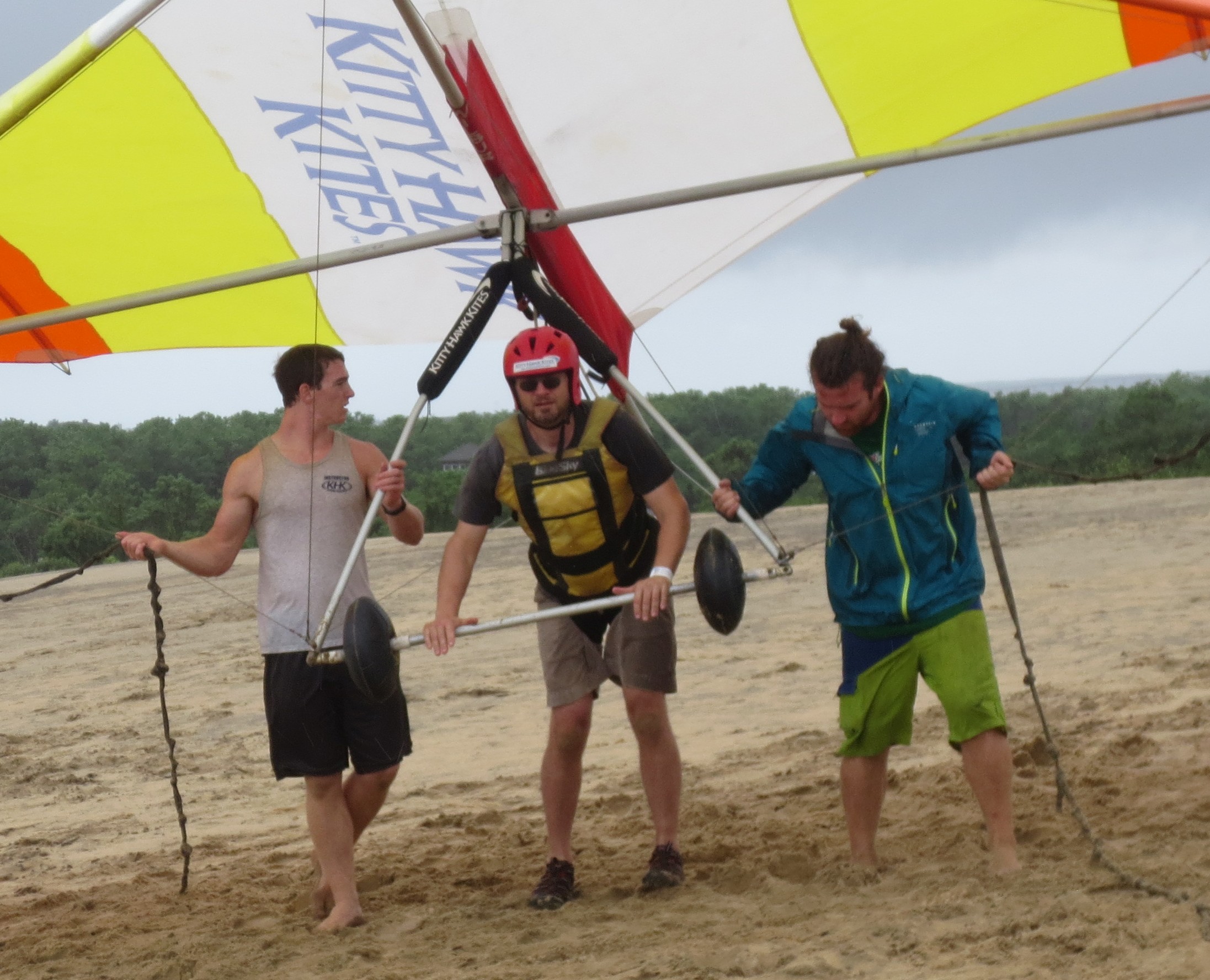
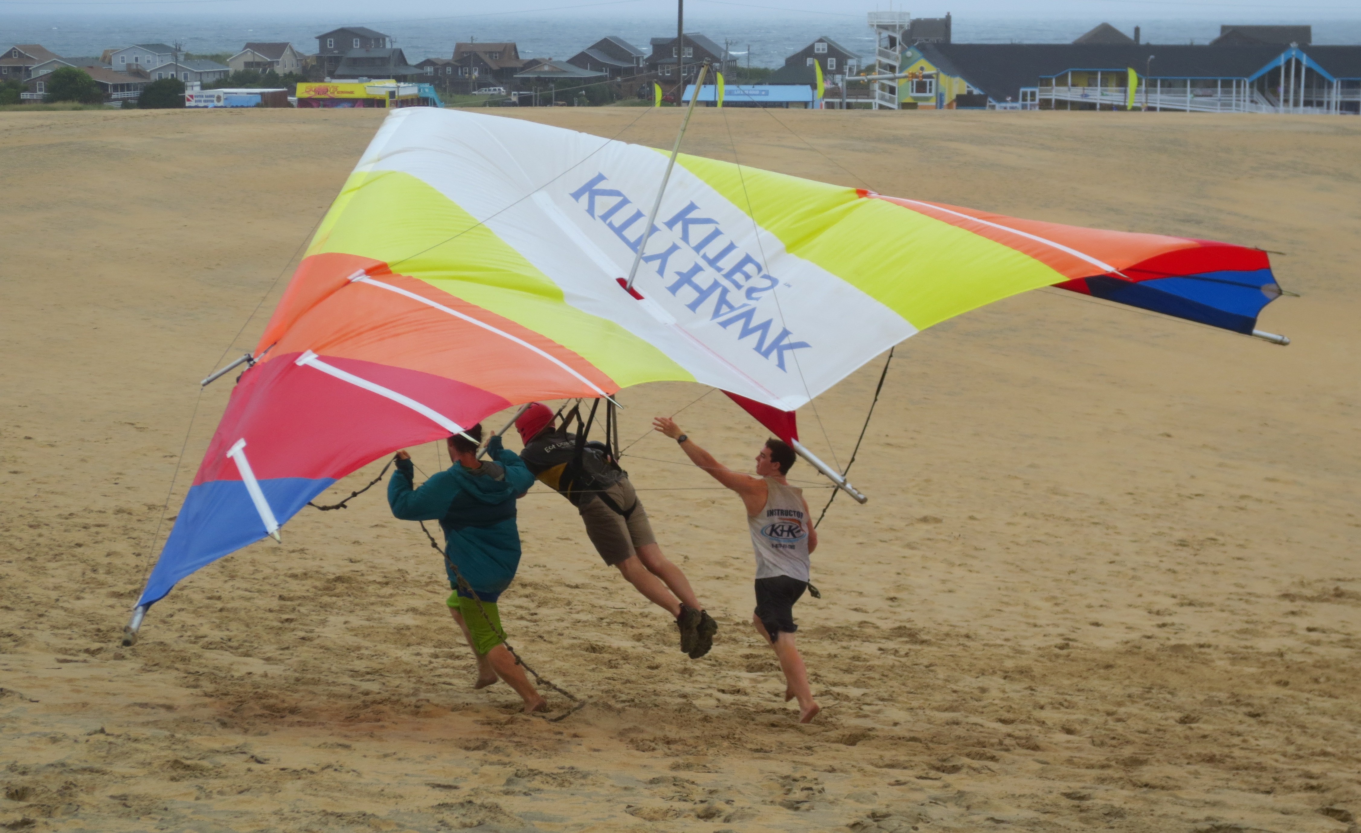
My only pre-planned event for this drive was hang gliding at Jockey’s Ridge — something I’ve always wanted to do. The experience itself was, admittedly, a little underwhelming, but it was still a significant life list item for me. Below are a few snaps of my less-than-elegant flights (flight instructors Hunter and Sterling are alongside):
* * *
The most powerful visual today (for me, at least) came at the end of the drive as I approached Hatteras. Right after spotting the iconic Hatteras lighthouse for the first time, I also became aware of the large swell of land that is home to Frisco and Hatteras looming out of the sound to my right. It is always impressive to me to see significant geographic features that are easily recognizable from space — in this case, the grand curve of the Outer Banks as they make a hard right turn back toward land — from a perspective on the ground that also allows me to make out those features (I think visiting Peninsula Valdes in Argentina is the only other comparable experience that I have had in the past several years). It makes the world seem like not such a big place, at least for a little while. No picture to accompany this; by the time I was aware of what I was looking at, the rain returned and washed out any chances for a decent photograph.
* * *
A few road misadventures to report that are tangentially related to my recurring theme of the sometimes-challenging juxtaposition of the highway and the beach. First, during the early stages of the tense drive yesterday up to Corolla, several of us were flagged down by a Southern Shores police officer who was doing yeomanlike work reminding everyone that crosswalks are not to be ignored on Highway 12. They are everywhere, and, while it makes driving that stretch even more stop-and-go, it is nice that Currituck has installed so many in an effort to add a human/pedestrian touch to counter the dominance of the oppressive train of cars on the highway.
Highway 12 is an incredibly busy two-lane highway at many points other than Corolla, as I had a first-hand opportunity to experience during misadventure #2 near the end of today’s drive. After leaving Jockey’s Ridge, I made the long but beautiful drive down the length of the Cape Hatteras National Seashore. Shortly after crossing the Bonner Bridge, I caught glimpses over the large dune that separates the highway from the beach at the north end of Rodanthe of several kite boarders. I pulled over quickly as soon as I saw a public access so that I could get a better look, but unfortunately I chose the one spot in Rodanthe without a substantial shoulder. Within seconds, the truck’s back tires were deep in soft sand. I abandoned the truck for a few minutes to go check out the boarders (the truck’s situation wasn’t going to get worse with time, and prioritizing things like the boarders was one of the goals of this trip anyway) before getting to work digging ditches that would be long enough, wide enough, and deep enough to give the tires some purchase on the finest sand I’ve ever encountered anywhere outside of a playground sandbox. I eventually got the truck out (after about an hour), but during that time, I was passed by several hundred fellow travelers, none of whom seemed interested in stopping to help. Just as I was about to make my final push off the shoulder and back on to the road, however, a truck with three young beachgoers who apparently were not in an incredible hurry stopped and offered to help with the final push. Tip of the hat to them for stopping to lend a hand.
